- About
- Admissions
- Study at AUS
- Prospective Students
- Bachelor's Degrees
- Master's Degrees
- Doctoral Degrees
- Admission Publications
- International Students
- Contact Admissions
- Grants and Scholarships
- Sponsorship Liaison Services
- Testing Center
- New Student Guide
- File Completion
- New Student Orientation
- Payment Guide
- Executive Education
- Students with Disabilities
- Academics
- Life at AUS
- Research
- Contact Us
- Apply Now
- .

First GNSS station with IGS service to be installed in the UAE
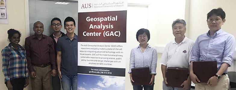
The Geospatial Analysis Center (GAC) at American University of Sharjah (AUS) is working to install the first Global Navigation Satellite System (GNSS) station in the UAE. To further this, AUS hosted six international visiting research scholars from the Shanghai Astronomical Observatory, Chinese Academy of Sciences, National Cheng Kung University and The Ohio State University this month. The team is collaborating on the installment of the first International GNSS Service (IGS) Station in the UAE, which will be part of the IGS network. The team carried out a pre-installation survey to identify potential locations of the stations along the coast of UAE.
The GNSS station pre-installation team includes Dr. Tarig A. Ali, Interim Director of the GAC; Dr. Shuli Song, Chinese Academy of Sciences; Dr. Chao Huang, Chinese Academy of Sciences; Dr. CY Kuo, National Cheng Kung University; Dr. CK Shum, The Ohio State University; and Huan-Chin Kao, National Cheng Kung.
The GAC is interested in collaborating with scientific entities of the world and its scientific objectives include the establishment of a stable CORS in Sharjah, for a variety of scientific research and applications, including improved realization of International Terrestrial Reference Frame (ITRF) coastal zone subsidence, and innovative coastal sea level monitoring (e.g. GNSS-R).
GNSS is a fundamental geodetic instrument with increasing innovative interdisciplinary scientific research and diverse applications, including navigation, mobility, geodynamics, atmosphere, meteorology, cryosphere, astronomy, sea-level and climate change sciences, precision orbit determination, geospatial/geodetic sciences, precision agriculture, urban planning, location/logistic services, smart cities, coastal vulnerability. The International GNSS Service (IGS) coordinates operational high accuracy GNSS Continuously Operating Reference Station (CORS) network globally, for unselfish collaborations, free data access to scientists and citizens of the world.

